


MARTELL - T 1 Voting District, Pierce County, Wisconsin
About
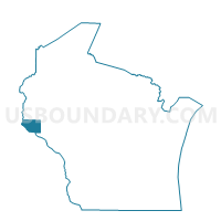
Outline

Summary
| Unique Area Identifier | 696146 |
| Name | MARTELL - T 1 Voting District |
| County | Pierce County |
| State | Wisconsin |
| Area (square miles) | 21.74 |
| Land Area (square miles) | 21.67 |
| Water Area (square miles) | 0.06 |
| % of Land Area | 99.72 |
| % of Water Area | 0.28 |
| Latitude of the Internal Point | 44.80709360 |
| Longtitude of the Internal Point | -92.42264720 |
Maps


Graphs
Select a template below for downloading or customizing gragh for MARTELL - T 1 Voting District, Pierce County, Wisconsin


Neighbors
Neighoring Voting District (by Name) Neighboring Voting District on the Map
- EAU GALLE - T 1 Voting District, St. Croix County, WI
- EL PASO - T 1 Voting District, Pierce County, WI
- ELLSWORTH - T 1 Voting District, Pierce County, WI
- GILMAN - T 1 Voting District, Pierce County, WI
- MARTELL - T 2 Voting District, Pierce County, WI
- RUSH RIVER - T 1 Voting District, St. Croix County, WI
Top 10 Neighboring County Subdivision (by Population) Neighboring County Subdivision on the Map
- Martell town, Pierce County, WI (1,185)
- Ellsworth town, Pierce County, WI (1,146)
- Eau Galle town, St. Croix County, WI (1,139)
- Gilman town, Pierce County, WI (959)
- El Paso town, Pierce County, WI (681)
- Rush River town, St. Croix County, WI (508)
Top 10 Neighboring Unified School District (by Population) Neighboring Unified School District on the Map
- River Falls School District, WI (22,944)
- Ellsworth Community School District, WI (11,180)
- Baldwin-Woodville Area School District, WI (8,697)
- Spring Valley School District, WI (4,071)
Top 10 Neighboring State Legislative District Lower Chamber (by Population) Neighboring State Legislative District Lower Chamber on the Map
Top 10 Neighboring State Legislative District Upper Chamber (by Population) Neighboring State Legislative District Upper Chamber on the Map
Top 10 Neighboring 111th Congressional District (by Population) Neighboring 111th Congressional District on the Map
Top 10 Neighboring Census Tract (by Population) Neighboring Census Tract on the Map
- Census Tract 1208, St. Croix County, WI (8,341)
- Census Tract 9602, Pierce County, WI (5,996)
- Census Tract 9607, Pierce County, WI (4,874)
- Census Tract 1209.04, St. Croix County, WI (4,036)
- Census Tract 9608, Pierce County, WI (3,698)
Top 10 Neighboring 5-Digit ZIP Code Tabulation Area (by Population) Neighboring 5-Digit ZIP Code Tabulation Area on the Map
- 54022, WI (22,358)
- 54011, WI (6,819)
- 54002, WI (6,278)
- 54015, WI (3,586)
- 54767, WI (3,221)
- 54003, WI (1,013)